Wildlife
Animals and insects that can bite, sting, charge, transmit disease, or otherwise injure people.

What Can Kill Me is a hazard map for hikers, campers, drivers, boaters, beachgoers, families and outdoor workers. The reports come from people who were just there. The warnings come from the National Weather Service, the U.S. Geological Survey, the National Park Service, NASA, regional avalanche centers, and more. All sit on the same map.
Five steps, none of which require you to understand a data feed, a coordinate system, or anything technical.
Start where you are, or move the map anywhere you are headed.
User reports and live agency warnings, side by side, with distance.
Tap a hazard for sourced guidance, where guidance exists.
From a safe distance, or later from memory by pointing on the map.
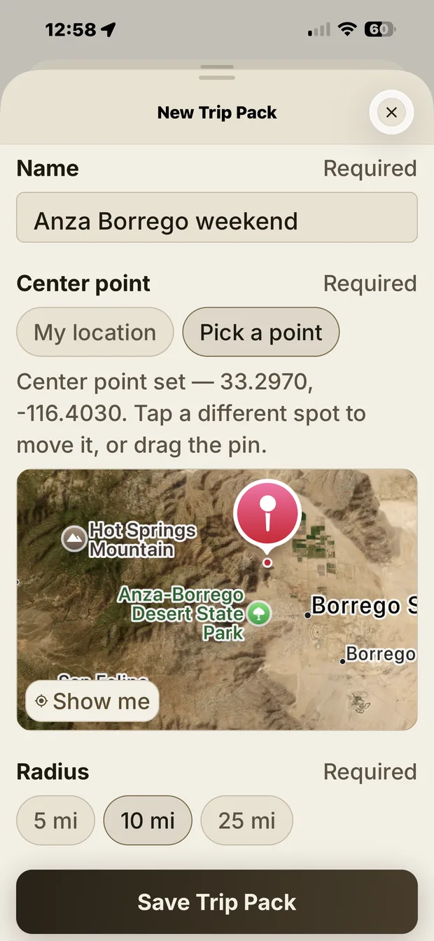
A Trip Pack keeps the area on your phone for where there is no signal.
Every hazard in the app belongs to a family, a subcategory and a specific hazard. That is what lets you filter the map, and what keeps a report from one person legible to everyone else.
Animals and insects that can bite, sting, charge, transmit disease, or otherwise injure people.
Storms, lightning, extreme temperatures, snow, ice, wind, and rapidly changing conditions.
Wildfires, prescribed burns, smoke, evacuation zones, and dangerous fire conditions.
Flooding, currents, cold water, surf, thin ice, and unsafe drinking water.
Cliffs, unstable ground, rockfall, avalanches, landslides, trail damage, and low visibility.
Threatening behavior, unsafe crowds, road rage, and areas people are telling each other to avoid.
Road closures, washouts, bridge damage, power lines, utilities, construction, and structural failures.
Poisonous plants, toxic mushrooms, thorns, irritants, spores, and other botanical hazards.
National Weather Service alerts, NASA FIRMS satellite fire detections, National Park Service closures, USGS earthquakes and stream gauges, avalanche forecasts, and iNaturalist observations.
Sourced guidance for 35 hazards, drawn from the National Park Service, CDC, Red Cross and state agencies: what to do before, what to do if it happens, and what not to do.
A photo, a severity and the time it was filed. Location and camera metadata are stripped from the photo before it is stored.
Other people confirm a hazard is still there. Nothing is expert-verified, nothing is official, and the app says so plainly rather than implying otherwise.
A circle around a trailhead, a campsite or home. New reports filed inside it are waiting the next time you open the app.
Save an area’s hazards and its agency phone numbers to your phone before you head somewhere with no service.
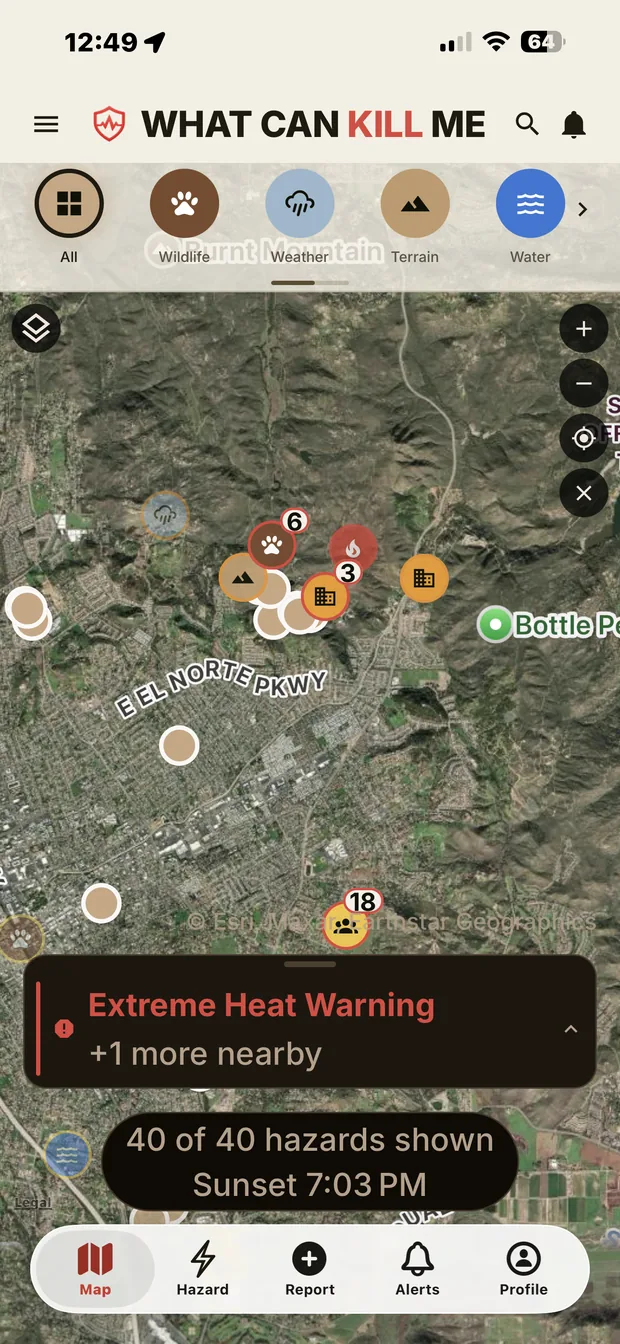
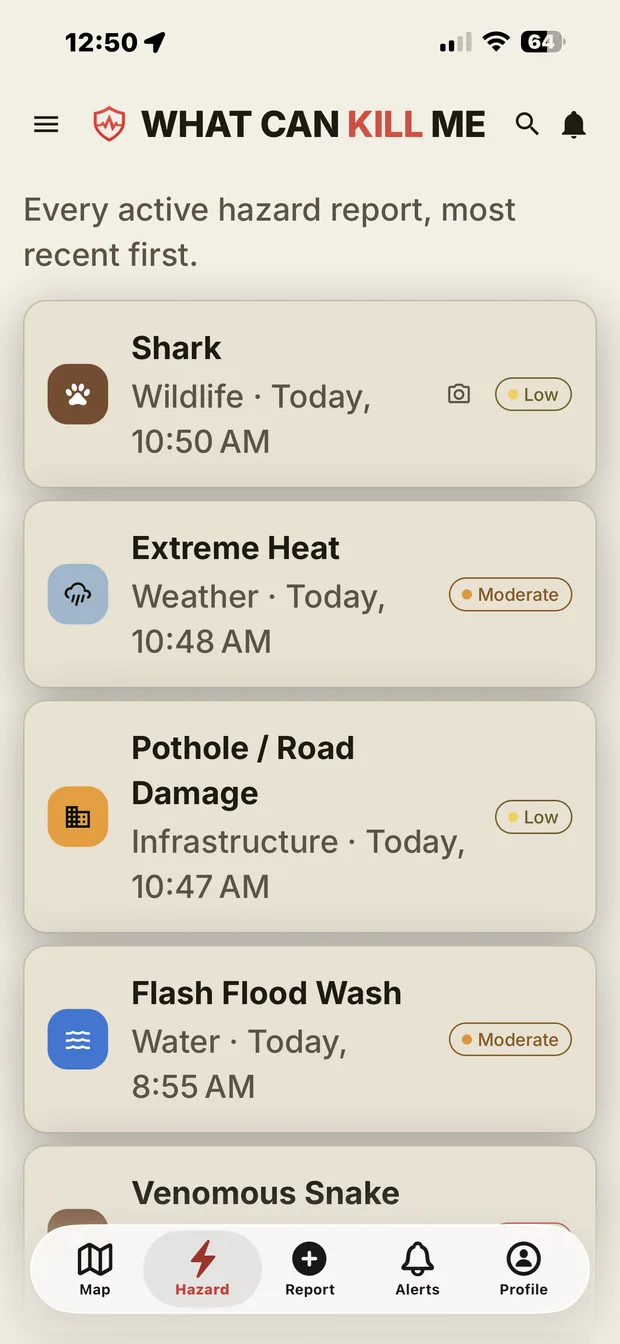
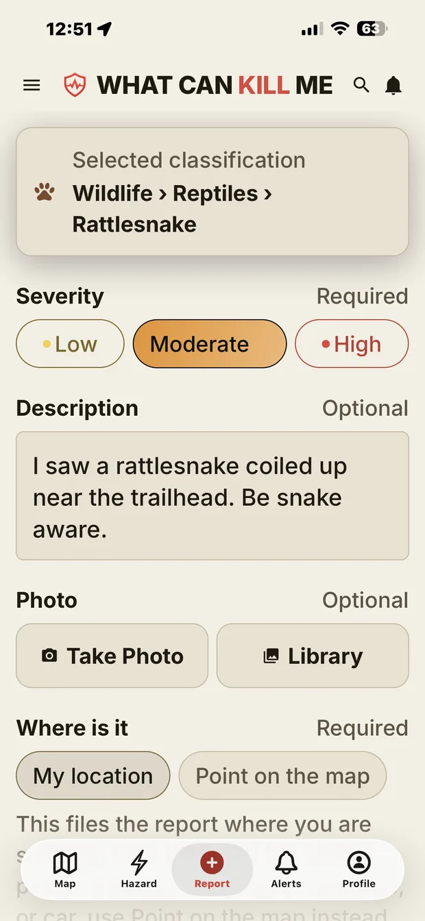
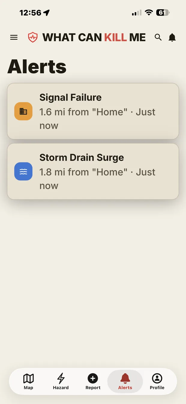
Screens from the build that is going to the App Store — not mockups.
This is the concept prototype the project started from. It runs on sample data, uses an older design, and shows several ideas that did not make the shipping app — a pre-trip scan, expert-verified reports, geofenced alerts and a risk score among them. What is and is not real in it. It is not the iPhone app, and it is not an emergency service.
These are project photographs, shown to illustrate how a picture helps someone recognize a condition before they walk into it.

Keep a safe distance and allow the animal an escape route.
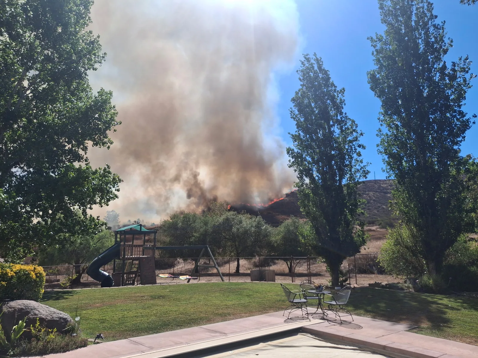
Active flames and smoke near structures require immediate official guidance.
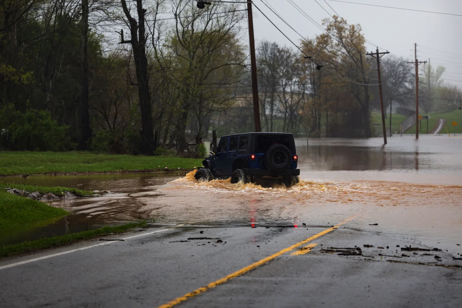
Never drive through floodwater; the road surface may be gone underneath it.
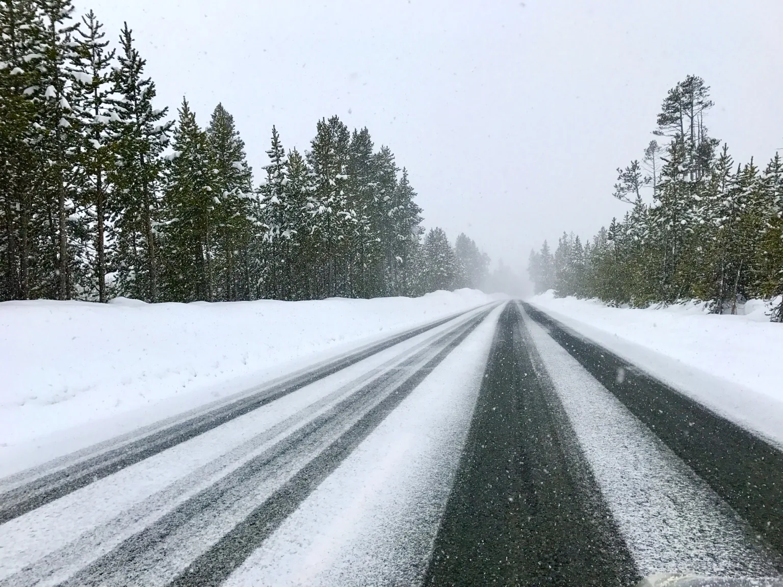
Reduced traction and visibility may make the route unsafe.
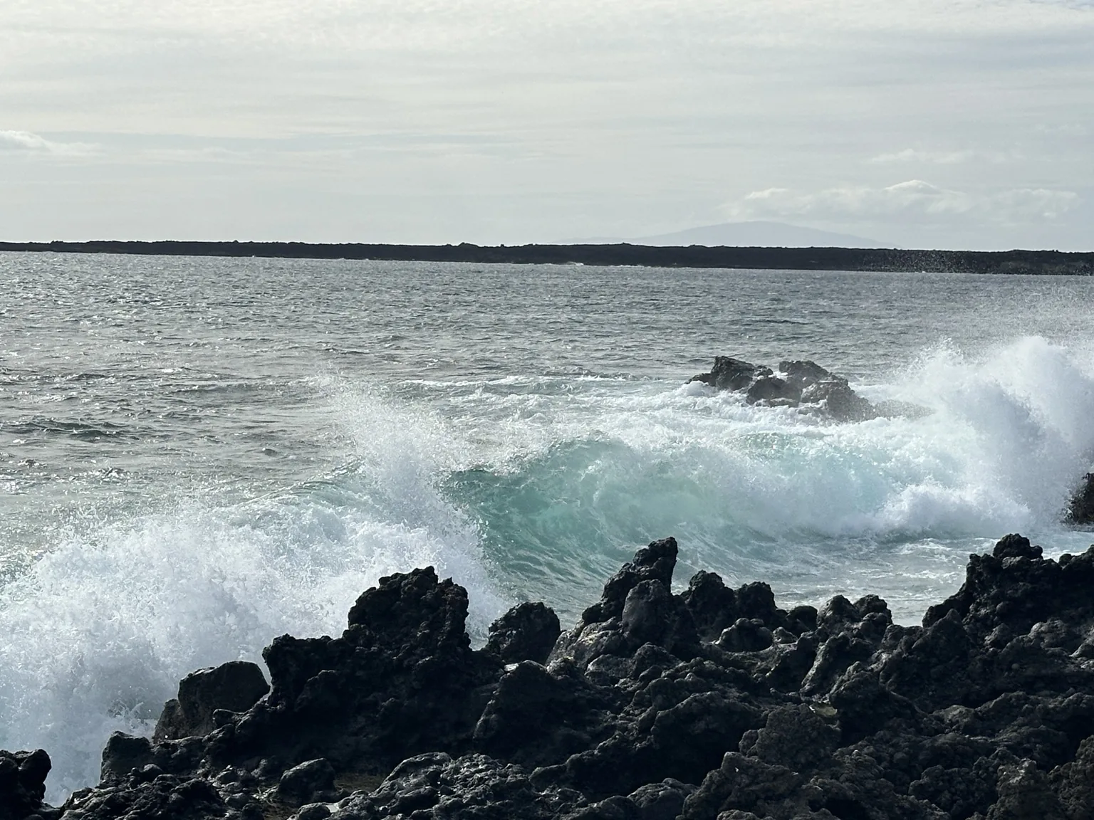
Breaking waves and sharp rocks create a serious injury risk.
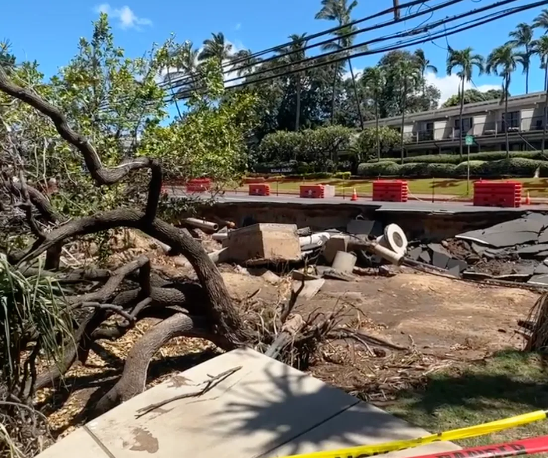
Roadway failure and exposed utilities require closure and professional response.
None of this exists in version 1.0. The app that ships is for individuals. These are the partnerships the platform is being built toward, and the conversations worth starting now — if one of these is you, get in touch.
Closures, wildlife encounters, trail damage, fire risk and changing access conditions, reaching visitors who are already looking at a map.
Helping visitors understand local hazards, seasonal risks and what to bring, before they arrive rather than after.
Wider reach for warnings that are already public, with community reports kept visibly separate from official ones.
Trip planning, safety education and hazard awareness for groups going somewhere unfamiliar.
Field observations from people already out there, and preparation support for communities facing environmental hazards.
Destination awareness folded into customer preparation, guided activities and duty-of-care planning.
The iPhone app is built, tested and in submission. It launches in the United States, for adults, and the whole safety app is free: every report, every live feed, check-ins, offline caching, reporting and confirming. An optional Premium membership adds unlimited Trip Packs and Alert Places, bigger alert circles and per-place hazard filters. No advertising on either plan, no analytics or tracking, and nothing about you sold to anybody.
Join the list and you will hear the day it goes live, along with what changed between the prototype on this page and the app that shipped.

Founder Michael Harlow is an author, filmmaker, PADI Scuba Divemaster, USCG 100 Ton Master with Sailing Endorsement, naturalist, educator, and founder of The Adventure Travelers.
Years spent hiking, sailing, diving, traveling, teaching and documenting wildlife kept surfacing the same problem: you can compare restaurants in seconds, but the practical local knowledge about what will hurt you is scattered across a trail comment, a government page, a neighborhood post, and a sign you only read once you are already standing at the beach.
Not quite. The iPhone app is finished and in submission with Apple. Join early access and you will hear the day it goes live.
No. Reports come from other users and are unverified. Official agencies and emergency services remain the authority, and the app is built to complement them, not replace them.
No. The app has no push notifications at all. Alert Places collect new reports inside the areas you saved, and you see them the next time you open the app.
Save a Trip Pack before you go and the area’s hazards, map tiles and agency phone numbers stay on your phone. A report you file offline sends itself when you are back in range.